A Hidden Gem in the Alpine Lakes Wilderness
This rugged high route offers sweeping views and rare solitude just 75 miles from Seattle
By David Gladish August 22, 2025

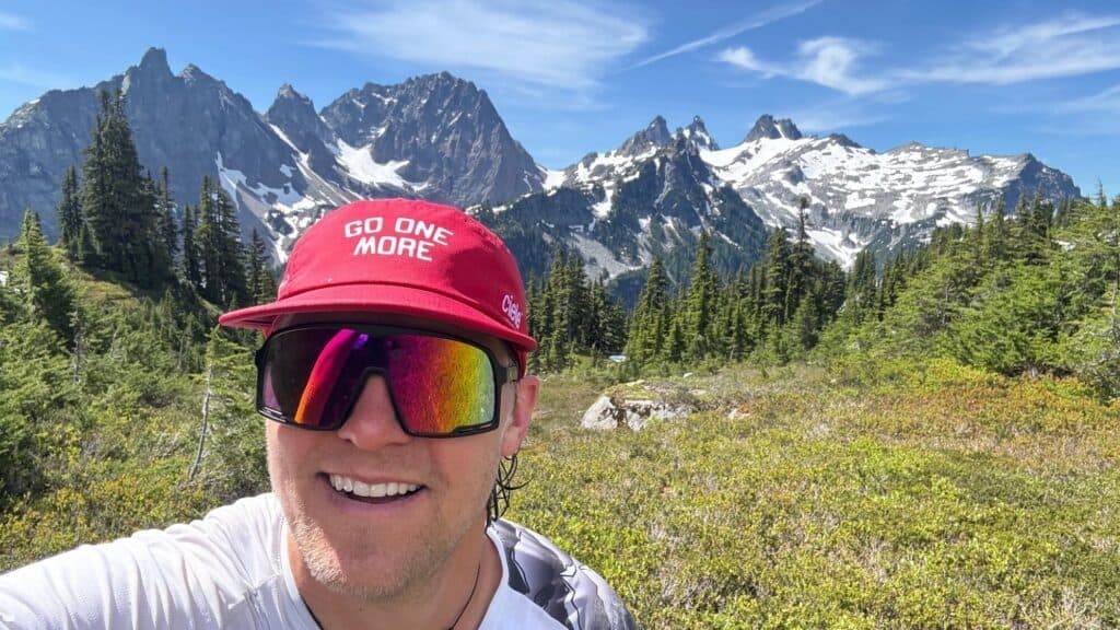
As I traversed a steep trail, five long hours after I started, I began to feel a bit lonely.
I hadn’t seen anyone for several miles, and the heat of the day was making my brain foggy. Then, around the corner, a hardy family of five—including three young kids—appeared, traipsing along like mountain goats, seemingly in their element. After exchanging pleasantries, I continued, feeling lighter and uplifted after a little human interaction.
The Alpine Lakes High Route is a 28.2-mile loop in the Alpine Lakes Wilderness near Skykomish, off Highway 2. The hike goes from the West Fork Foss trailhead to the East Fork Foss trailhead, or vice versa, with either a 2.5-mile car shuttle or a hike on the road connecting the trailheads. The route travels through the Necklace Valley, named for the string of pristine alpine lakes dotting the wilderness like teardrops on a beautiful piece of jewelry.
Tank Lakes, at 5,800 feet, is a highlight, with spectacular views of the Overcoat Glacier streaming down from Chimney Rock, just a stone’s throw from Snoqualmie Pass.
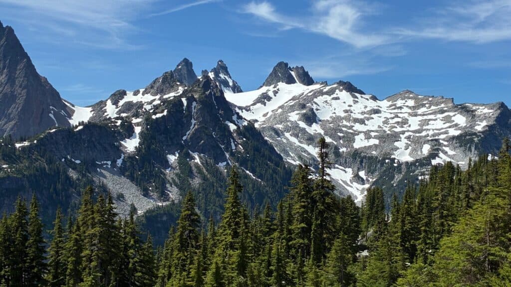
The hike is rugged at times, traversing boulder fields without a marked trail, and requires strong navigational skills, but the payoff is solitude. Many consider the Enchantments, just outside of Leavenworth, to be Washington’s finest mountain playground, for good reason. The Alpine Lakes High Route shares many of the same attributes—stunning vistas, strings of lakes, and high mountains—but without the crowds or the need for an overnight permit.
I chose to do the route in a single day, part of my training for a 100-mile trail running race, but this route is a perfect multi-day backpacking trip thanks to the plentiful water sources along the way. When I did the hike in early July, there were a few patches of snow to cross, adding an element of mountaineering adventure. Throughout the day, I longed to dive into the frigid, crystal-clear lakes, but pushed on instead.
In the early morning, I passed sleeping campers, happy dogs, and plants covered in morning dew. By mid-morning, a few hikers were on their way out, but I mostly had the trails to myself. How is this possible, I kept thinking, that there aren’t more people in such a beautiful place?
With over 8,000 feet of elevation gain, fitness is certainly required, but not a heroic amount. Mosquitoes can be an issue, using GPS is practically a must, and rescue is far away—all part of the allure. Just 75 miles from Seattle, the trail feels extremely remote. It’s full of wildflowers, marmots, fields of granite, and splendorous views. Yet there I was, by myself, meditating on how lucky I was to be in such a beautiful place, so close to home, without a soul in sight.
Follow Us

Grange Estate Brings Modern Luxury to Dundee Hills
Foley Wines created a hidden-gem hospitality experience in Oregon’s popular vineyard region.
I have a confession. Although I have long loved Pinot Noir, it wasn’t until January of this year that I visited Oregon’s Dundee Hills, a 12,500-acre American Viticultural Area about 30 miles southwest of Portland. I’ve spent time in the Tri-Cities, Walla Walla, the Columbia Gorge, and even Portland proper, but for some reason had…

Like Nowhere Else
Muckleshoot Casino Resort. The biggest and best in the northwest.
Photos courtesy of Muckleshoot Casino Resort. Located south of Seattle, Muckleshoot Casino Resort offers a truly unforgettable escape—one with indulgence, relaxation, and exhilaration, all right at your fingertips. Whether you’re planning a thrilling night out, a spontaneous staycation or a memorable weekend away, this is the experience you’ve been looking for. Our luxurious hotel has…

Winter Isn’t Over Yet
Why now might be the best time to take your kids skiing.
For many avid skiers in the Pacific Northwest, this winter has been a bust. Drier-than-normal conditions and a lack of snow have put a real damper on powder days, lift operations, and access to the mountains. As an avid backcountry skier, I’ve noticed the lean conditions and have not made it a priority to get…

The Rise of the Experience Economy
REI brings back guided travel, betting that memories matter more than stuff.
In my household, with two young boys under the age of five, we often have to remind them to take things back. Did you really mean to tell dad that his dinner isn’t good? You might want to take that back. Did your brother deserve to be hit? Let’s rethink that one. Extreme analogies aside,…